
Multiple Systems Are Being Monitored
There is a growing potential for a tropical depression or storm brewing in the Atlantic over the next week or two as a tropical wave leaves Africa. The basin is historically approaching its most active time of the year.
Here’s what we know.
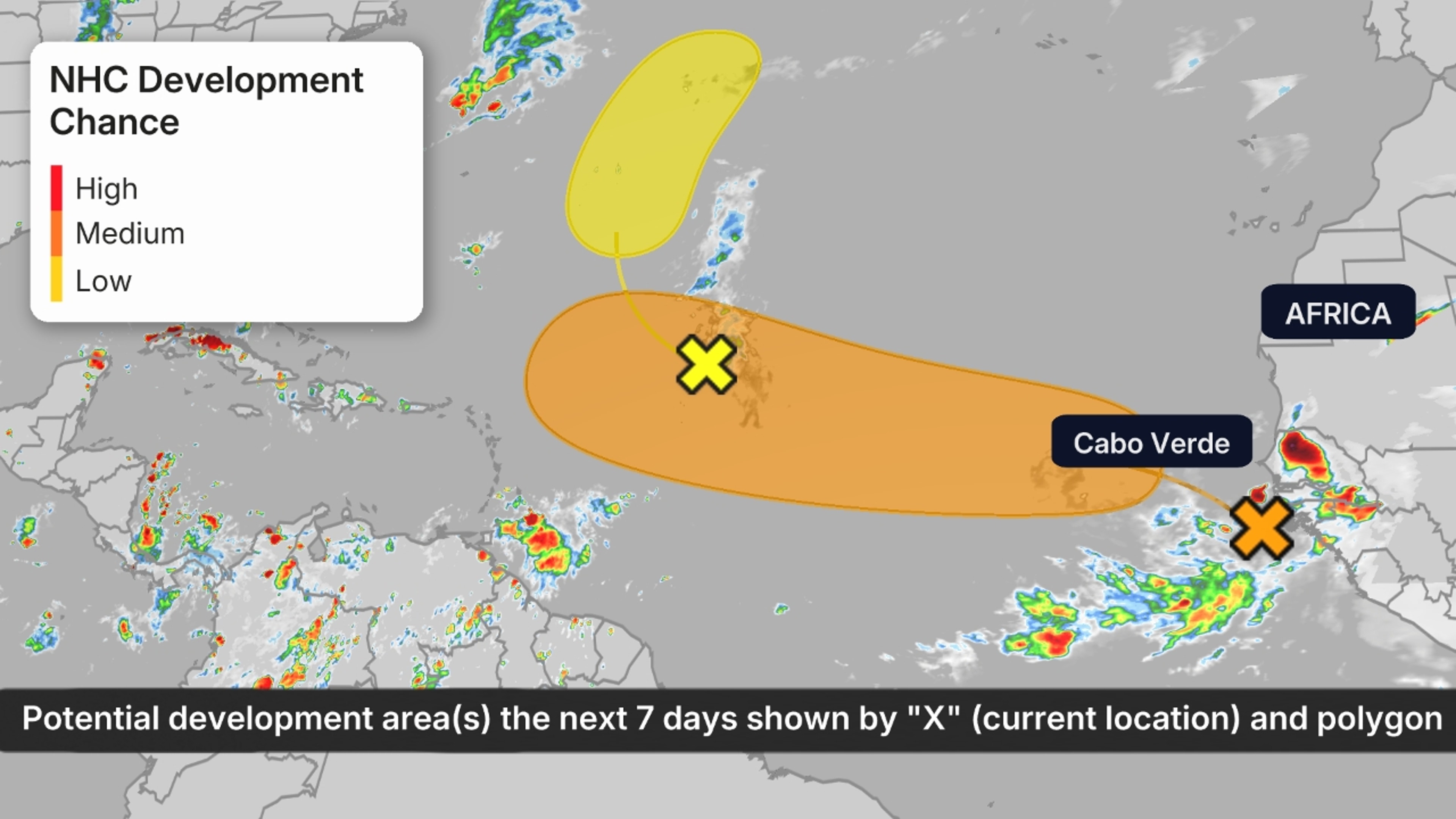
The One To Watch: Tropical Wave Crossing The Main Development Region
The bottom line: A tropical wave is crossing the lower latitudes of the Atlantic and could have some impacts in the northeastern Caribbean next week. Computer models are honing in on the idea of a tropical depression or storm developing from this wave. Impacts are possible closer to home, but it is far too early talk about what those could be.
Weather in your inbox
(MORE: What Is A Tropical Wave?)
The details:
- A tropical wave left the coast of Africa on Friday with a large envelope of disorganized thunderstorms. Development chances are growing and computer guidance is suggesting we’ll be watching this system for a while.
- The system has been tagged as Invest 97L by the National Hurricane Center. Systems are tagged in order to run specialized computer models to better determine the projected path and strength of the system. Here’s more on what invests are.
- With an environment of warm water, low wind shear and gradually increasing moisture, this tropical wave could develop into a tropical depression or storm as soon as mid-week between Africa and the Lesser Antilles.
- This next tropical system could eventually pose a threat in the northeastern Caribbean as soon as next Friday.
- The next tropical storms in the Atlantic Basin will be named Erin, followed by Fernand.
- Down the road: Computer ensemble guidance suggests this system will be roughly somewhere between Cuba and Bermuda 7-10 days from now. This part of the forecast is low-medium confidence. Impacts to that region and any threats to the United States are very uncertain.
Tropical Development Potential
What Else We’re Watching:
– Central Atlantic System: An area of lower pressure called a tropical wave is in the central Atlantic Ocean, where it’s producing a few disorganized showers and thunderstorms as it’s fighting dry air. It could develop into a depression or storm over the next day or two as it curls north well east of Bermuda. This is not a U.S. threat.
– The rest of August: Climatologically, there is a steep uptick in activity from the beginning of the month to the end. This activity can come from the central or western Atlantic, Caribbean or Gulf. Additional tropical waves are expected to roll off the coast of Africa every few days.
(MORE: Hurricane Season’s Main Event: Why August Typically Kicks Off The Atlantic’s Most Active Time)
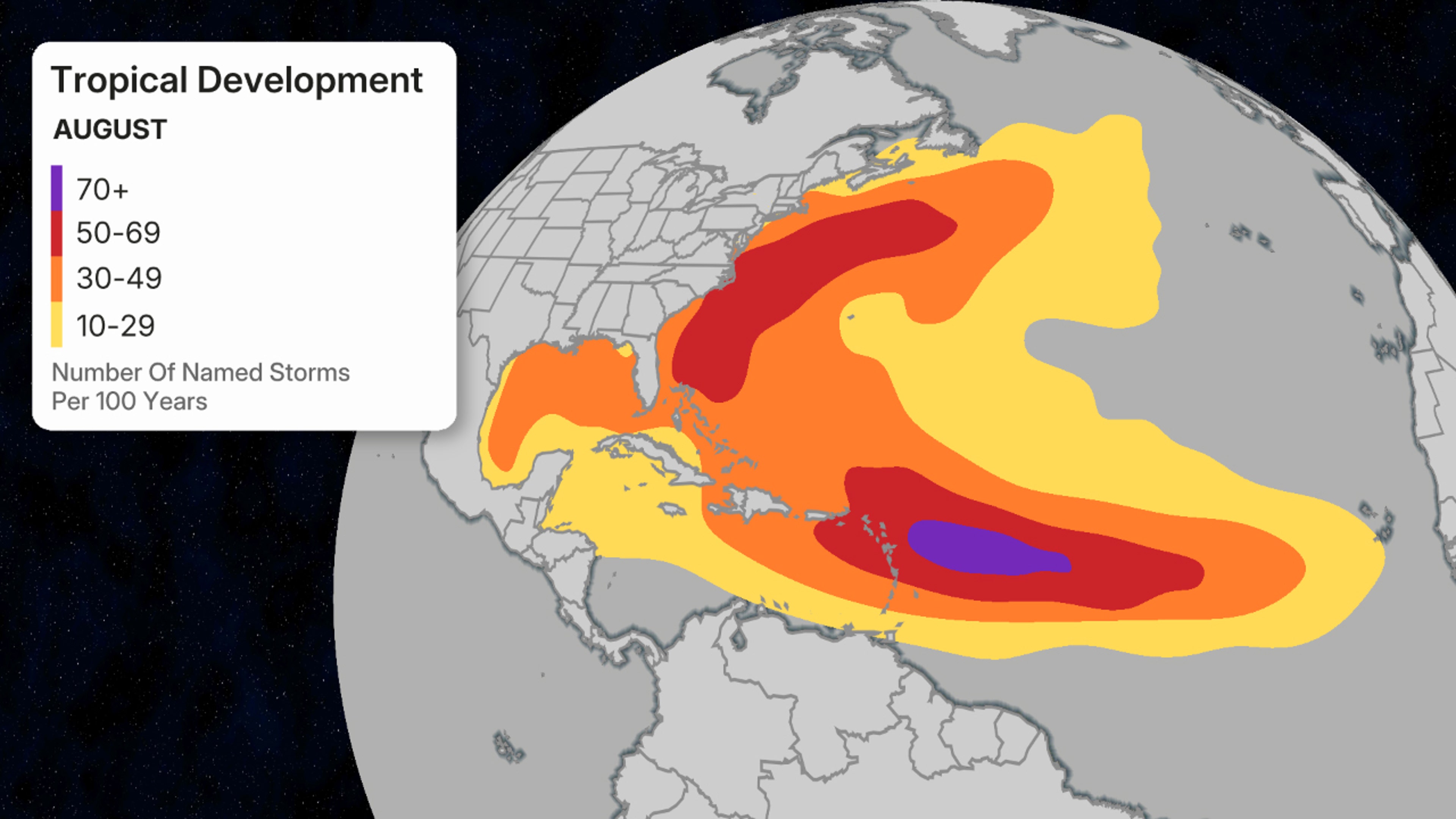
August’s favored named storm formation areas.
(Data: National Hurricane Center)