
Inland areas once again reached the 80-degree mark for a fourth day in a row on Tuesday, a pretty remarkable stretch for early October. But it is October, not July, and this is about to come to a screeching halt.
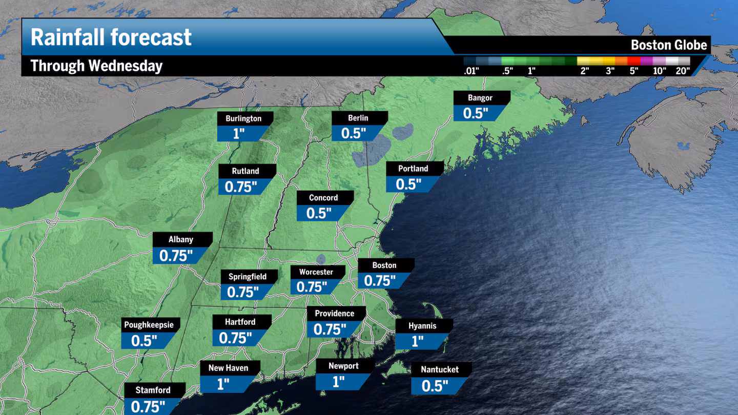
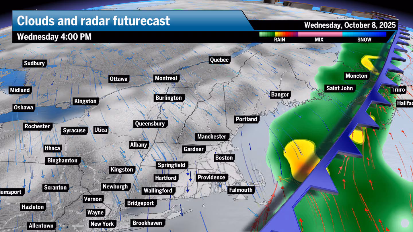
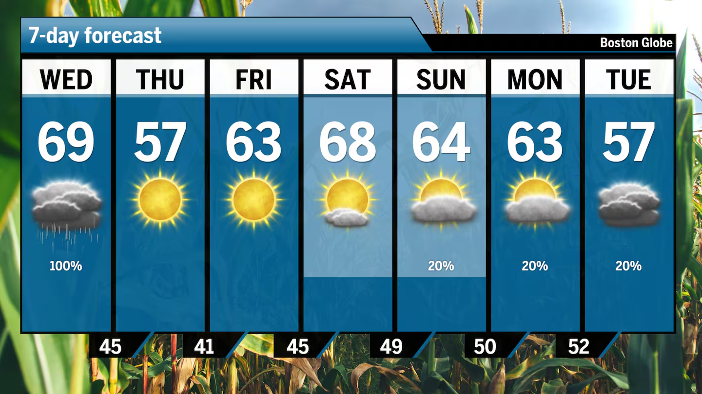
A cold front is rapidly approaching the region and will not only bring an end to the warm weather but will also bring some much-needed rainfall during the first half of Wednesday. If you head into work really early, you may beat the heaviest of the rain. But much of the morning commute will likely see showers, some downpours, and even the rumble of thunder in the Boston area. Most areas will receive a half an inch to 1½ inches of rain, with a few spots going over that mark during some of the heavier downpours.
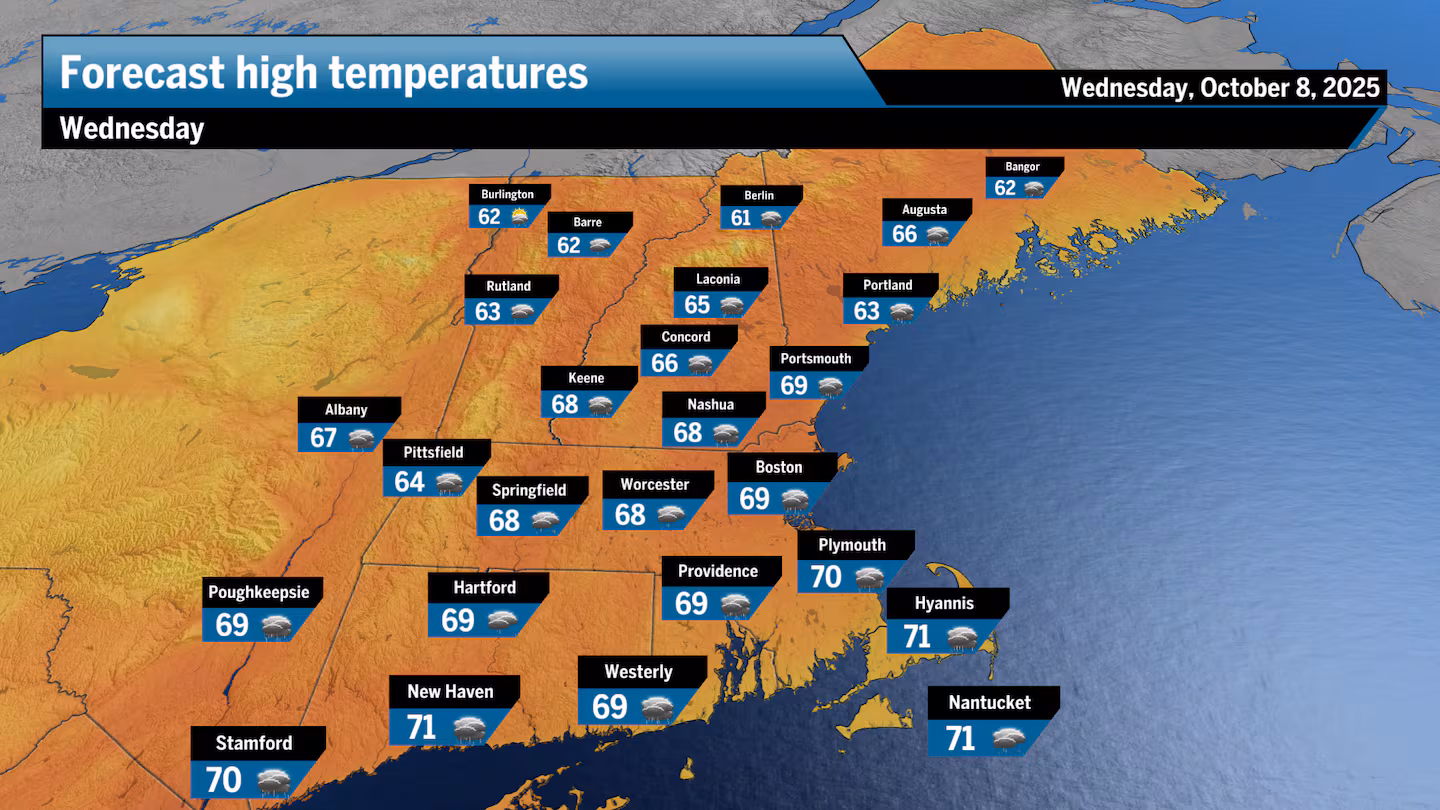
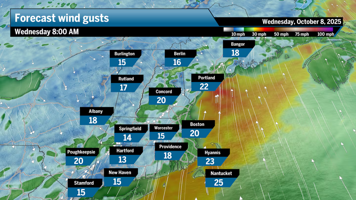
Morning temperatures will be warmer than usual, in the 60s, and it will still feel slightly muggy at sunrise before the drier air arrives later in the afternoon. Temperatures will reach the upper 60s in the afternoon. The wind will start from the southwest before flipping to the north in the afternoon as the colder air filters in.
Clearing takes place before sunset, and then temperatures tumble down into the 40s Wednesday night and early Thursday.
On Thursday, there will be plenty of sunshine with that autumnal air back in the picture. Temperatures will struggle to reach the mid- to upper 50s.
For those of you with house plants outside or gardens that you want to keep going, you’ll have to cover things up Thursday night into Friday, especially if you are away from the coastline. The normally colder spots are definitely going to see a frost and perhaps even a freeze for Friday morning. This is seasonally average, but since we’ve had all the warm weather, you may not be quite ready for it.
Temperatures on Friday afternoon will rebound only into the 60s, and if your plants do make it through that cold morning, there’s no more chance of frost for at least a week or more. Presently, the weekend looks seasonable with temperatures in the 60s on Saturday and low 60s on Sunday, along with a few more clouds and a chance for a shower.
Greater Boston: Look for showers the first half of Wednesday with a few downpours and the rumble of thunder. Temperatures will be in the 60s. It’s cooler with highs in the 50s along with sunshine for Thursday.
Central/Western Mass.: Showers and even the rumble of thunder Wednesday morning come to an end with late-day clearing, highs in the 60s. It’s sunny with temperatures in the 50s for Thursday
Southeastern Mass.: Showers develop in the morning on Wednesday with a gusty southwest breeze flipping to the north in the afternoon, along with the rain coming to an end. Temperatures will be in the 50s on Thursday with sunshine.
Cape and Islands: Rainfall moves in from the northwest during the morning on Wednesday with showers tapering Wednesday night, followed by clearing for Thursday. Highs will be in the 60s on Wednesday and around 60 for Thursday.
Rhode Island: Showers overspread the area early Wednesday and taper off in the early afternoon. Temperatures will be in the 60s. Look for brilliant sunshine for Thursday with highs in the 50s.
New Hampshire: Rain comes to an end before noon on Wednesday, with highs in the mid-60s. It’s sunny and breezy on Thursday, with highs in the 50s.
Sign up here for our daily Globe Weather Forecast that will arrive straight into your inbox bright and early each weekday morning.